Title | Sustainable landscapes in Zanzibar |
Year | 2005-2007 |
Leader | UTU Geography (N. Käyhkö) |
Funding | MOSSE/Ministry for Foreign Affairs of Finland |

The Ministry for Foreign Affairs of Finland and the University of Turku made an agreement to implement a research project, Sustainable landscapes of Zanzibar, after the completion of the previous project on the islands. The Project commenced in May 2005 and finished at the end of 2007. The project was a collaborative effort with the Department of Geography, University of Dar es Salaam and part of a larger research program called MOSSE (Luonnon monimuotoisuuden tutkimusohjelma).
Finnish development cooperation in Zanzibar has addressed environmental issues in accordance with the policy aim to promote sustainable use of natural resources and protect the environment. Zanzibar islands have experienced dramatic changes in land use and land ownership throughout their history and in particular since the introduction and increase of clove cultivation during first half of the 19th century. The political and economic interests of the settlers and rulers, their religions and ideologies have made an impact on the landscapes, land use and land ownership systems. Recently the insecure land ownership together with rapid population increase, political changes and growing needs of the institutional as well as commercial land users have further initiated a concern over the sustainability of land use practices and natural resources in Zanzibar.
Finnish development cooperation in Zanzibar has been operational via development projects in forestry (1980 – 1996), land and environment management (Zilem) (1990-1996) and Smole (Sustainable Management of Land and Environment, 2003-2009) activities. Landscape changes in Zanzibar, or in any other region to that matter, is an obvious consequence of development. With appropriate policies and managerial systems and tools and skills, which combine technological capabilities and consideration of the values in the society through participation, the changes can produce sustainable results.
The Zanzibar islands can be roughly divided into two potential agricultural land use categories, namely the deep soil and the coral rag areas. Deep soil areas are characterised by permanent cultivation and forest, and the coral rag by shifting cultivation and consequent scrublands. However, neither of these areas is stable in terms of its land cover and biotope characteristics. Hilly deep soil areas are more susceptible for soil erosion, simultaneously facing population pressure and public land use demands, which all cause constant changes in land cover patterns and natural resources. On the other hand, shifting cultivation typical to the coral rag areas creates a constant element of change, which under the pressure of diminishing area due to commercial and conservation land use may change from its typical circular pattern towards deterioration of valuable biotopes and natural resources.
The initiatives for the research project were based on the possibilities brought into light by the project “Interaction between forest plantation and community and its impact on biodiversity” (2003-2004). The idea was to involve local people and their local knowledge of the area, in the process of valuing landscapes and biotopes for different land use purposes and bring this information into a geographical context together with the data of the physical landscape parameters and their changes. This kind of spatial information system was visioned to act as a knowledge base for future land use development plans, including Resource Use Management Agreement (RUMA) system used in Zanzibar in the community based forest management. Furthermore, the 2003-2004 research project collected valuable spatial and temporal data sets extending from the 1930’s to the present day from a selection of Shehias at Unguja. These data sets were proven to be very valuable in the change analysis of land cover and biotope patterns and lot of interest towards their further use was expressed by the environmental officials in Zanzibar. Opportunities for further research on the topics of landscape changes, stakeholder participation and landscape sustainability were explored in this subsequent research project.
Many of the current problems in the sustainable management of natural resources are confronted in the interface between people and the environment. Research usually seeks to explain why and how environments evolve and where environmental problems such as loss of biodiversity arise, but the solutions to these problems lie in the actions of people and the way they value and use the land. Landscape ecology is a challenging research branch as it simultaneously tries to explore the physical and social sides of environmental changes. Landscapes are dynamic systems characterised by various configurations of land cover and vegetation, which change and evolve through time and space. As majority of the world’s landscapes are and have been shaped by human activities, landscape ecology is fundamentally about understanding interactions between humans and their environment. The causes and consequences of landscape changes lie in the spatial and temporal interplay between different natural factors, such as climate, topography and vegetation and soils, and humans as the main agents of landscape changes. Landscape studies, which aim at analysing these change transformations, are called Landscape Change Trajectory Analyses (LCTA).
The project utilized Landscape Change Trajectory Analysis to analyse landscape sustainability on the islands. It was used to dismantle the driving forces and the main consequences of landscape dynamics in respect of present-day landscape and biotope patterns. Geographical Information Systems (GIS) was used to analyse landscape information between different spatial data sets and over different time periods. These techniques enabled integration of landscape information originating from maps, aerial photographs and field observations. GIS and cartographic visualisation techniques were also explored in participatory way to collect and sort information from different stakeholders involved in the interest areas.
Summary of the findings:
From the analyses of land use potential:
• By merely viewing the chemical and textural properties of the soil samples, it is clear that the geology of Unguja Island is the main soil forming factor at island scale, and that there is a clear distinction between the soil of the western deep soil region and the soil of the eastern coral rag region
• The rationale for shifting cultivation and common knowledge that coral rag region suffer from nutrient depletion can be questioned, as the soils of the coral rag region contain significantly higher nutrient levels than soils in the deep soil region. Even in the recently cultivated areas in the coral rag region, the soils had higher nutrient contents than in the natural forest areas of the deep soil region.
• Differences in soil properties are local, especially in the coral rag region where soils with similar nutrient levels are not spatially correlated. This indicates high entropy or randomness in the landscape.
• Higher nutrient values in the deep soil region were associated with older forests and younger forests showed significantly lower nutrient levels. This suggests a very long recovery time of soils after reforestation.
• Land cover and land use practice influence soil properties at local scale. Generally the less intensive the agriculture and the more natural vegetation cover the higher the soil nutrient content
• In the coral rag region the nature of land cover changes in the past showed little influence on the soil properties today, however in the deep soil region past changes had a larger influence on present day soil properties
• Mixed cultivation, such as agroforestry, would be a more sustainable form of agriculture in the coral rag region, as it would maintain organic matter and nitrogen content as well as cation exchange capacity and soil moisture.
From the analyses of woody vegetation and community important species:
• Casuarina equisetifolia -plantations have slightly higher amounts of indigenous vegetation than Acacia auriculiformis –plantations. The highest average differences in total number of woody species individuals in acacia and control areas were found in Chaani and Cheju and much lower in coastal shehias of Matemwe and Kiwengwa
• Largest numbers of acacias are found in the vicinity of the plantations, but acacias are able to spread naturally outside plantations, especially in disturbed habitats.
• The average number of recorded acacias is higher in deep soil than in coral rag area, which indicates that acacias do grow better and their spreading is more vigorous in deep soil conditions. It is, however, difficult to predict how large problem the natural spreading of acacias could be in the future, since too little time has passed since establishment of the plantations
• Community important species reflect available resources of the shehia and thus Dole and Cheju have different selection of community preferred woody species. In Cheju these include more indigenous species and third of the species have biological value as endemic or target species of the Coastal forests of Eastern Africa. In Dole, the selected study species preferred intermediate habitats, that is fern thickets, semi-open grasslands, forest plantations and habitats growing fruit trees and shrubs.
• In Cheju, the highest average numbers of individuals and species were found in indigenous shrubs or forests and the lowest numbers in cultivated areas. In Dole, the lowest average numbers were found in cultivated areas and forests.
From the analyses of land cover and land use patterns and changes:
• Crop cultivation is a primary source of local livelihoods in Dole, but large indigenous forests diversify livelihoods in Kiwengwa, where cultivation is only one means of income.
• The spatial variability of land use patterns in Dole and Kiwengwa reflect the relative importance of different land uses, availability of land for cultivation and land suitable for cultivation.
• Land use patterns in Dole reflect close interactions with urban areas where there is a large demand for food crops. In Dole, there is dominance of food and tree crops that in some cases surpass domestic requirements.
• From the 1990s, farmers in Kiwengwa have planted casuarina on their croplands, especially along the coast. This reflects the increased demand for the construction material stimulated by the expanding built-up areas along the coasts.
• Population growth is fast in the coastal and urbanizing shehias of Unguja. These shehias show substantial increase in the amount of buildings and length of road network during the past 50 years, but patterns of development vary according to the locations of the shehias.
• In Kiwengwa the amount of buildings had arisen from 334 in 1989 to 1506 in 2004 due to tourism industry. In Dole, the number of buildings has increased from 101 in 1952 to 1720 in 2004 and influence of growing urban region of Zanzibar town is reflected in this development. Most rural shehia Cheju, shows less dramatic changes in the settlement pattern.
• Generally, coral rag landscapes and forests show high degree of forest sustainability, but the total amount of forest cover is gradually diminishing. In general, this would imply that communities lay increasing pressures on the forests and these cause gradual losses (descrease) of forested environments.
• Coral rag landscapes perform rapid land cover turnover, where forests are re-established and lost frequently. These changes are related to shifting cultivation and are so extensive that very few forest areas are sustaining unused. Forests seem to be able to regenerate after removal, but this process will lead into dominance of younger generations of coral rag vegetation. Mature forests seem sustain only in the areas where protection measures have taken place. This development is unsustainable since in ideal case both community livelihoods and diversity of forested environments could be co-existing.
• Long-term and temporary forest losses are occurring parallel in studied shehias. Traditional community livelihoods (shifting cultivation) cause temporal forest loss but tourism and associated stakeholder activities change land cover more permanently.
From the analyses of local livelihoods:
• The rural villagers and the communities have traditionally had several income sources and diversified livelihood strategies relying on agriculture, animal husbandry and fishing. Local communities have never been entirely dependent on a single source of income.
• Seasonality of the activities is one of the key factors, which makes the diversity of the livelihood activities possible
• Nature is important for rural villagers and their knowledge of the properties of different plants is generally high. For example, traditional medicines are important and many of these plants have become scarce resource.
• The seaweed cultivation in the coastal areas, the rise of tourism industry and intensified trade have modified the traditional way of life even in the more remote rural communities. These developments have brought about new opportunities and resources, from which the communities can benefit.
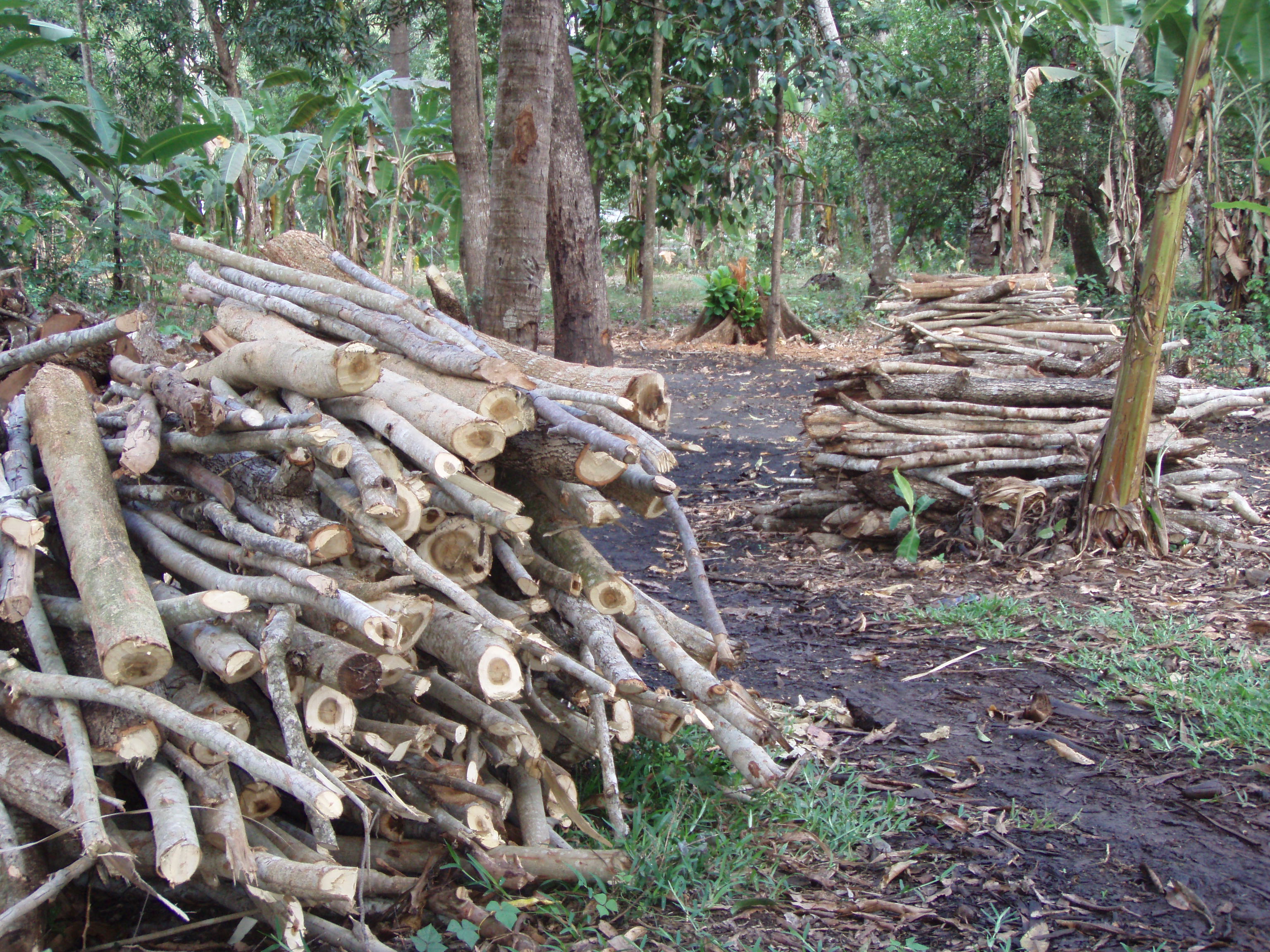
• Almost all villagers complained some degree of shortage in firewood and wood for construction and most of them had also noticed that natural environment had degraded during the years.
• Majority of the informants had been involved in tree planting and forest plantations have played a predominantly positive influence on their lives.
• Tourism has influenced local perceptions on land ownership and land use rights. Previously communal land tenure has become individual, and individual benefits from land sales have influenced the traditional community coherence.
• Tourism-induced changes are simultaneously positive and negative. The main positive influence is emergence of new livelihoods. Typical negative influences are insults on the Islamic culture, informal housing development, increased insecurity, rising living costs and land shortage.
• There are two different visible trends in the development of the livelihood strategies in Zanzibar. The economic activities in the community level as well as island-wide are diversifying, as the new income generating activities have entered the lifeworlds of the villages. Traditional subsistence-based livelihood activities are now competing with the commercial seaweed cultivation as well as formal and informal activities of the tourism industry. However, in the individual level the development seems to be quite the contrary, as the diversity of the activities is decreasing.
• The economic systems can now be considered as two-dimensional: on one hand, there is the subsistence economy, which is based on the use of local resources, which are still important for the livelihoods of the community members, and on the other hand, the market-oriented economy based on the provision of services for the tourism industry and the trade of local resources.
From the participatory analyses of indigenous knowledge and land use preferences:
• There are several land use constraints in the shehias. These include homesteads, village settlements, and conserved forests. In Dole, constraints cover about third of the land area while over 80% of Kiwengwa is restricted for the local land uses. The main causes for the restrictions are government (conservation areas, government institutions) and tourism.
• Four factors affect people’s choices of the preferred croplands. These are soil suitability, distance to the farm, security of tenure for the farmlands, and the presence of animal pests that eat the crops. Crop cultivation and socio-economic status of farmers in Dole and Kiwengwa shape the communities’ image of croplands preferences and other land uses.
• In Dole, there are substantial amount of under-utilised areas of the government institutions. Villagers regard these suitable for future agricultural activities to cope with increasing pressures on the land. In Kiwengwa, gazetting of the Kiwengwa-Pongwe Forest Reserve is likely to increase land use pressures in other areas. Meanwhile, the tourism industry is expanding rapidly. All these land uses are limiting access to land that local inhabitants need to cater for their increasing demands and this could be the breeding ground for potential conflicts among the stakeholders.
• The individuals who gave high priority to environmental concerns differed within and between the stakeholder groups. The need for fuel wood from the forest reserve of Dole-Masingini was given high priority by the Mtoni local community while environmental concerns were pointed out by some stakeholder groups, such as DCCFF and NGO’s.