Launch of the Finland-Africa Platform for Sustainable Development Goal 9 (Innovation)

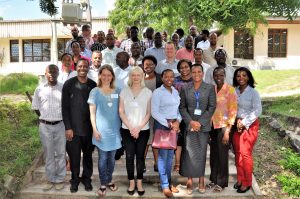
The Launch of the Finland-Africa Platform for Sustainable Development Goal 9 (SDG9) (Innovation) was organized at the University of Turku between 26th and 27th of August 2019. The collaboration and the MoU (Memorandum of understanding) agreement between university of Turku and the United Nations Economic Commission of Africa (UNECA) is strengthening the role of Finland in meeting the UN SDGs especially in the field of Innovation.

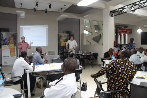
The seminar included renowned speakers such as Li Anderson (Minister of Education of Finland), Jukka Kola (Rector of university of Turku), Minna Arve (Mayor of Turku) and Oliver Chinganya (Director at UNECA). The speakers highlighted the importance of boosting innovation activities in African countries as a part of meeting the SDG. Finland, with its long history and experience in education, research and development, can be an important partner in supporting this positive development.

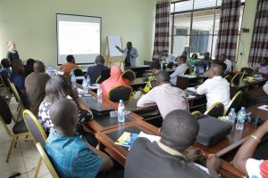
The launch of the platform had purposely a wide perspective on the topic and collected participation form around Finland and internationally, especially from Africa. The development of the platform continues this autumn, which practically includes identification of organizations and planning of concrete actions.

Read more about the event (in Finnish) from the news of university of Turku.

In addition, visit the web page for the event.

UTU Tanzania team and four Tanzanian universities developing geospatial expertise to control risks posed by floods and climate change.

Students during their industrial training doing field work by collecting coordinate of the most flooded areas in Dar es Salaam using mobile phones (photo by Chris Morgen).

In the Resilience Academy project (web page under construction) UTU Tanzania Team together with four Tanzanian universities is tackling the challenges faced by cities in Tanzania by developing three components:

  1. Climate Risk Database using Geonode service
  2. Open-access education materials regarding the usage, analysis, and visualization of data contained in the Geonode
  3. Long-term vision for the Ramani Huria internship program. The project aims to increase data availability and geospatial expertise by education development.

These issues are crucial in Tanzanian cities which are especially vulnerable to the extreme phenomena caused by climate change and flooding due to population growth and weak urban planning.

The project is funded by the World Bank through the Tanzania Urban Resilience programme. The project is coordinated by the University of Turku and is realised by the Ardhi University, University of Dar es Salaam, Sokoine University of Agriculture and State University of Zanzibar in Tanzania.

For more information see the news bulletin from University of Turku.

Group photo of all participants during the Kickoff of Resilience Academy 12 December 2018 (photo by Msilikale Msilanga).
The world Bank signing the MoU with Ardhi University for Ramani Huria Internship Program (photo by Chris Morgen).

The report on the participatory mapping tools in official VLUP process in Tanzania is out now!

A report on the participatory mapping tools in official village land use planning process in Tanzania is out now! The report is published together by UTU Tanzania team and Private Forestry Programme and it lays out step by step The tools have already been adopted into practice in five districts of the Southern Highlands and interest on them is likely to increase via the publication. Download the report here!

The tools are a result of UTU Tanzania team’s nearly ten year long research work on the use of participatory mapping solutions with communities in Tanzania mainland and Zanzibar. 

A more comprehensive Practitioner’s manual on the same tools will be published by the National land Use Planning Commission early next year in Tanzania.

Our research on participatory mapping yields tools for official land use planning in Tanzania

Throughout 2017 UTU Tanzania team co-developed a practitioners’ manual on participatory mapping tools for official village land use planning in Tanzania. Finally early this April the manual was presented and refined in a three-day stakeholder workshop. The workshop gathered together over 40 Tanzanian land use planning actors among them academia, authorities and NGOs. It was an inspiring forum for sharing experiences on the use of simple spatial technologies to support active community engagement and production of high quality land use plans at village level. We are expecting to publish the manual by the end of the year in order for more practitioners to take advantage of the tools in Tanzania.

The development of the planning tools and the manual has been a joint effort together with the National Land Use Planning Commission of Tanzania and Private Forestry Programme of Ministry of Foreign Affairs of Finland and Ministry of Natural Resources and Tourism of Tanzania.


(Image left) The Director General, Dr. Stephen Nindi, of the National land Use Planning Commission addresses the stakeholder workshop participants in Morogoro. (Right) Participatory mapping tool in use during land use planning in one of our collaboration villages.

New project GEO-ICT started

We have received funding from the Ministry for Foreign Affairs of Finland (HEI-ICI programme) for a project “Geospatial and ICT capacities in Tanzanian Higher Education Institutions (Geo-ICT)”. The project is about improving the quality of higher education and research environment in geospatial and ICT capacities, and strengthening the role and relevance of these sectors in the development of the society.

This project is a shared effort between the Department of Geography and Geology and Department of Future Technologies of UTU with four Tanzanian Universities: University of Dar es Salaam (UDSM), Ardhi University (ARU), StateUniversity of Zanzibar (SUZA) and Sokoine University of Agriculture (SUA). The duration is from March 2017 to March 2020 (3 yrs).

The Kick-Off event of the project was organised in Dar es Salaam on May 17-19th, 2017.

Recent news (in Finnish) about the HEI-ICI funded projects at UTU News.

Geospatial Collaboration Supports Business Development in Tanzania

Tanzania offers Finnish geospatial companies a possibility to become international and to create new services. At the same time, the companies take sustainable business to Tanzania and support the development of local business culture. The University of Turku is involved in the project that aims to develop new business solutions related to geospatial and ICT technologies for the markets of developing countries.

Read more at UTU news or the same article in finnish.

Geospatial Business Ecosystem project has started with three Finnish companies

Geospatial business ecosystem in Tanzania (GESEC) is a project consortium of University of Turku (UTU) and three Finnish geospatial companies: Arbonaut Oy, Dimenteq O and Vionice Oy and their business and academic partners in Tanzania. The project is implemented through a time period of 2 years together by the UTU Departments of Geography and Geology and Future Technology, in close team work with GESEC companies and Tanzanian academic, business, NGO and government partners. 

See more at the section projects and follow us in Facebook.